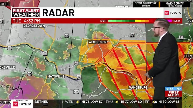
Severe thunderstorm warnings covered Warren County, Ohio, on Tuesday, as storms moved through the area and prompted alerts for damaging winds, flash flooding and possible tornadoes across the Mason and Deerfield Township region.
Weather tracking service RadarOmega posted video on X showing a severe thunderstorm moving through the Socialville area of Warren County Tuesday afternoon. The National Weather Service office in Wilmington issued warnings for the region as part of a broader Tri-State outbreak.
The greatest danger window ran from approximately noon to 5 p.m., according to FOX19 NOW, which elevated its severe weather coverage for the Cincinnati Tri-State region. Forecasters identified damaging straight-line winds as the most significant threat, capable of knocking down trees and causing power outages.
Additional warned hazards included flash flooding in low-lying areas and places with poor drainage, large hail capable of damaging vehicles and property, and a few isolated tornadoes. Heavy rainfall was a particular concern where storms repeatedly moved over the same locations, as saturated ground could not absorb additional water. The FOX Forecast Center reported peak rainfall rates of up to 2.5 inches per hour were possible during the storm system.
Part of a larger outbreak
Tuesday's storms were part of a multiday severe weather event affecting more than 116 million people across the eastern United States, with the Storm Prediction Center rating the threat at Level 3 out of 5 for 35 million people.
Butler County Sheriff Richard K. Jones shared on X that the NWS in Wilmington had issued a severe thunderstorm warning for Hamilton County and southern Butler County, immediately west of Warren County.
Confirmed damage in neighboring Clermont County
While no damage reports were available from Warren County at the time of publication, the storm's impact was confirmed in neighboring Clermont County, which borders Warren County to the south. A tornado warning was issued there Tuesday, and a tree fell on a home during the storm.
Clermont County resident Denise Davis told CNN affiliate WKRC that she rushed her grandchildren to the basement when the warning sounded. "The winds picked up, the lights were flickering and then I heard a real loud bang, which of course was the tree falling onto the house," Davis said.
What comes next
Storms were forecast to gradually weaken Tuesday evening and move out of the area by Wednesday morning. Wednesday's forecast calls for noticeably cooler and less humid air, with only a stray sprinkle possible and most neighborhoods expected to stay dry, according to FOX19 NOW.
No confirmed damage reports, power outage numbers, or official statements from Mason Police, Mason Fire, Deerfield Township Fire and Rescue or Warren County Emergency Management were available at the time of publication. Residents should call 911 to report storm damage or emergencies.