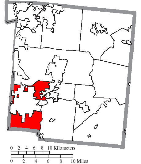
Mason and Deerfield Township residents face another round of severe thunderstorms Thursday night into Friday morning, with the National Weather Service warning that already-saturated ground will make flash flooding hit faster and trees fall more easily than in a typical storm.
The NWS Wilmington office issued a weather briefing Thursday, Aug. 13, outlining two waves of storms. The first, a round of isolated storms between 6 p.m. and 11 p.m. Thursday, could bring damaging winds and possibly isolated tornadoes. The stronger wave arrives overnight, with bands of heavy rain carrying a greater risk of flash flooding and strong, damaging winds.
The ground is already soaked.
Days of prior rainfall have saturated the soil across Warren County and the broader region. The NWS Wilmington office warned on X that flooding will occur quicker than normal and gusty winds will knock down trees more easily, potentially causing additional power outages on top of the thousands already being repaired from earlier this week.
A flood watch covers southwest Ohio, including Warren County, until 11 a.m. Friday, Aug. 14. The NWS Wilmington office identified southwest Ohio as the area with the highest flash flooding risk, with the danger greatest overnight into early Friday morning.
An additional 2 to 4 inches of rain is expected to fall on the area Thursday night, according to WLWT meteorologist Steven Albritton. Some creeks and streams are already running high and could flood with additional heavy rain.
As we reported Thursday, most Warren County power has been restored following the Aug. 11 storms, but roughly 52,000 Duke Energy customers across the Greater Cincinnati region remained without power as of early Thursday morning. Tonight's storms threaten to knock out lines again before crews finish repairs.
Neither Mason police nor Deerfield Township Fire Rescue had issued public statements about the overnight storms as of Thursday afternoon.
What residents should do
The weather service advises residents to be prepared for immediate action if heavy rains begin, avoid low-lying areas and use caution approaching highway dips and underpasses. Residents near waterways should monitor NWS river forecasts online.
Storms are forecast to move out of the area by late Friday afternoon, with highs around 84 degrees. A lingering chance of rain continues Friday night into the weekend. Residents can check Warren County Emergency Management updates at the county's emergency services website or follow @WCEMAOhio on social media for local alerts.